| A National Natural Landmark | Tumbling Creek Cave | Field Trips and Professional Short-Courses | Home |
| Available Journals | References on Tumbling Creek Cave | Help Needed | Contact Information |
Protecting the Cave and Its Ecosystem
Tumbling Creek Cave is the only known habitat for the Tumbling Creek Cavesnail. An initial reconnaissance survey in 1974 found a population of about 15,000. The current population is about 1% of this. Concern over the dramatic decline in the population led to periodic snail counts by Dr. Ashley of Missouri Western State University beginning in 1996 and continuing to the present. Initially there were four statistically based population counts made per year; that number has been decreased in recent years to two per year. The census results led to the emergency listing of the snail as endangered on December 27, 2001 and final listing as endangered on August 14, 2002. The recovery plan (McKenzie 2003) was signed in September 2003. The dedication of Dr. Ashley to enhancing the understanding of this cavesnail and making the numerous snail counts has been a critically important conservation effort and permitted the listing of this species. His work also facilitated Dr. McKenzie and the cavesnail recovery team in rapidly developing a recovery plan for the cavesnail (McKenzie 2003). Important funding was provided by the U.S. Fish and Wildlife Service.
 A water quality monitoring station was installed in August 2002 in the Big Room of the cave as a part of the snail recovery efforts. It records flow rate and water temperature, specific conductance, turbidity, and dissolved oxygen concentrations. Results indicate that turbidity is declining due to conservation programs on lands that contribute water to the cave. Dissolved oxygen concentrations do not appear to pose problems for the snails. Funding for the instrumentation was provided by the U.S. Fish and Wildlife Service.
Preliminary work has been conducted on captive propagation of cavesnails using a surrogate species to refine techniques and identify problems. The water planned for use in this propagation is from a deep well on the cave property. Use of this water will remove the threat that the snails might be harmed or killed by a pollution event that impacted water in the cave stream. An important capability of the captive propagation facility is that it could be used as emergency habitat for cave invertebrates in the event of a highway spill on any of the 5.6 miles of state and federal highways and 3.2 miles of county roads that pass through the cave’s recharge area.
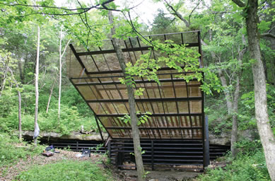 A large chute-type gate has been constructed on the Bear Cave entrance. The unique gate design was necessitated by the fact that the cave is a maternity site for gray bats (Myotis grisescens), and pregnant bats will not fly through more conventional gates. The chute design works well and protects the cave and its fauna from people who might otherwise illegally enter the cave. The construction was under the direction of Roy Powers of the American Cave Conservation Association and Bill Elliott of the Missouri Department of Conservation. A large number of volunteers helped in the construction. Funding was provided by the U.S. Fish and Wildlife Service and the Missouri Department of Conservation.
Over 2,700 acres (4.22 square miles) of land is owned by the Tumbling Creek Cave Foundation and Tom and Cathy Aley. This land has been acquired to protect the cave and its groundwater system in twelve different purchases during the period 1966 to 2009. In addition, other landowners have cooperated in the protection of the cave and the associated groundwater system.
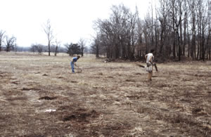
The cleared area in the center of the photo is being returned to native vegetation. The riparian corridor planted to native tree species is on the bottom right of the photo. |
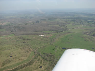
Much of the recharge area for Tumbling Creek Cave is shown in this photograph. Pelham Hollow, a major losing stream that contributes water to the cave, isin the foreground. |
|
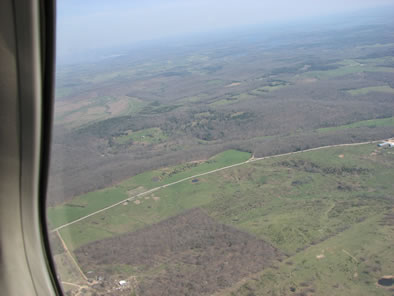
Much of the recharge area for Tumbling Creek is shown in this photograph. |
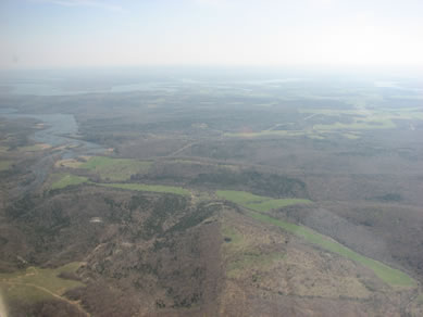
All known cave passages are in the ridge just beyond the grassy valley. Bull Shoals Lake is in the upper left. |
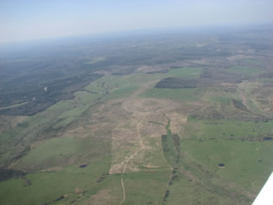
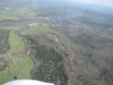
All known cave passages underlie the ridge in the center of the photo. The cave ridge is bordered on the left by Hampton Hollow and on the right by Bear Cave Hollow; Big Creek is in the background. |
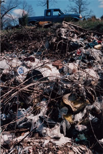
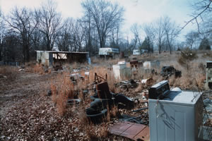
In or closely adjacent to the 9 square mile recharge area for the cave we identified 32 household or roadside dumps. With funding assistance from the U.S. Fish and Wildlife Service, the Missouri Department of Conservation, National Park Service, and the L.A.D. Foundation, and with volunteer help from caving groups and friends, we have collected and removed all of the trash from 31 of the dumps. The last dump (spread over a couple of acres) is on land acquired by the Foundation in September 2009 and is scheduled for cleanup during the winter and early spring of 2010. Some of these dumps were on lands owned by the Foundation or the Aleys, but we also cleaned up dumps on several other properties. As of the end of 2009 we have removed and recycled (or taken to landfills) about 110 tons of scrap metal, several truckloads of electronics, two truckloads of broken toilets, over 100 gallons of potentially hazardous liquids, miscellaneous partly full pesticide containers, several truckloads of empty paint and oil cans, a truckload of (yuck) used Pampers®, over 400 tires, at least 5 tons of asphalt shingles, and one wrecked mobile home. We have another wrecked mobile home to remove during the winter of 2010.
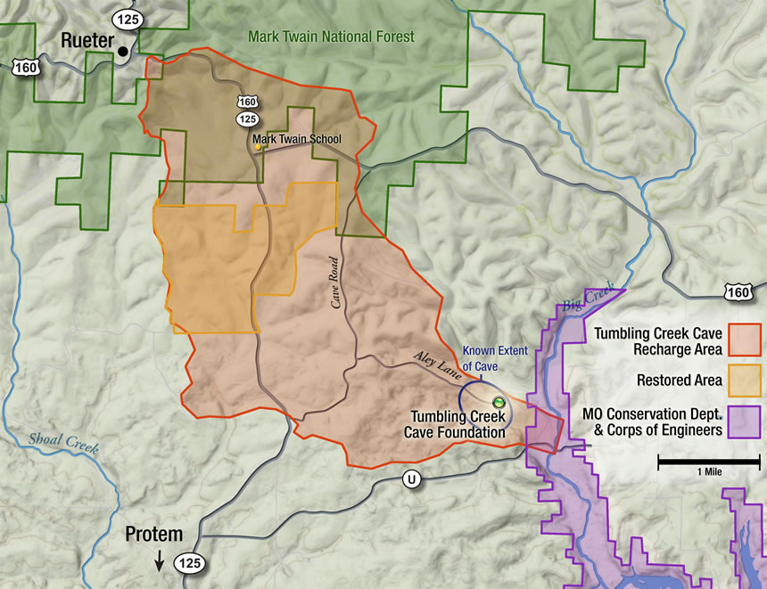
Figure 1, which shows the recharge area for the cave, also identifies a restored area. On these lands, which were predominantly heavily over-grazed pasturelands, we have:
- Closed, repaired, and revegetated 3,200 feet of eroding logging roads and skid trails.
- Removed two failing earth-fill dams containing approximately 400 cubic yards of soil at sites upstream of major sinking points on Sinking Creek.
- Repaired and revegetated 13,000 feet of erosion gullies where the typical gully was 5 feet wide at the top, two feet wide at the bottom, and 4 feet deep. An estimated 6,700 cubic yards of soil had eroded from these gullies prior to their repair.
- Repaired 1,600 feet of eroding stream channels and adjacent stream banks.
- Converted 100 acres of fescue pasture to native grasses and forbs.
- Rehabilitated 50 acres of native glade.
- Planted 9 bottomland species of trees on 180 acres of riparian corridors. This was a total of 75,000 hand-planted trees. All of the riparian corridors were fenced to exclude cattle.
- Installed a livestock watering system in Sinking Creek to eliminate the need for cattle access to the stream.
- Cleaned up all the dumps.
- Removed 10 tons of decaying creosote treated railroad ties from a sinkhole.
- Instituted a rest-rotation grazing program to rehabilitate lands previously over-grazed and to protect water quality.
- Conducted major control efforts on invasive exotic plant species including Russian thistle and spotted knapweed.
Photos for this section could include tree planting, rock check dams, trash cleanup, and gully rehabilitation.
 Funding assistance for these conservation programs was provided through the U.S. Fish and Wildlife Service, Missouri Conservation Foundation, Missouri Department of Conservation, Conservation Reserve Program of U.S. Department of Agriculture, and the Missouri Native Plant Society. In addition, a tremendous amount of volunteer work was contributed by a number of individuals including especially Ron Oesch and John and Dorothy Stade.
The Mark Twain School is in the recharge area for the cave and is shown on Figure 1. Dye tracing by the Ozark Underground Laboratory showed that a failing sewage system at the school yielded untreated sewage to Tumbling Creek Cave within a few days. In a major cooperative effort involving 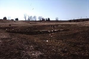 the Ozark Underground Laboratory, Taney County Commission, Missouri Department of Conservation, U.S. Forest Service, and two individuals the entire cost of a high quality new sewage treatment system ($89,000) was raised without any money coming out of the school budget. The local newspaper headline read: “Endangered species saves school”. See Anon. (2006) for a story about the school and the cavesnail.
 There are approximately 22 private residences in the recharge area for Tumbling Creek Cave that are served by septic systems. With grant funding from the U.S. Fish and Wildlife Service and the L.A.D. Foundation we pumped out 13 septic tanks, inspected the systems, and funded upgrades to six inadequate systems.
All of the septic systems at the Ozark Underground Laboratory have been connected to a sewage line that transports all treated effluent outside the recharge area for the cave and to an area with good soils suitable for a large on-site leach field. This system includes one pumping tank with pump and controls, one gravity tank, and approximately 3,500 feet of conveyance line. Funding assistance was provided by the U.S. Fish and Wildlife Service through The Nature Conservancy.
 A parcel of 50 acres overlying part of the East Passage and Clearwater Creek in the cave was an old pasture that had been invaded by thick growths of Eastern red cedar and honey locust. These trees were cleared by chainsaw and chipped. Using control burns the area is being converted to an oak savannah. The project was begun in 2007. Partial funding for the initial clearing was provided by the Missouri Department of Conservation.
A severe ice storm in late January 2009 deposited nearly three inches of ice and severely damaged or destroyed at least 30% of the trees that were at least 40 years old. All roads and trails were blocked and three buildings sustained minor damage. On the most important tracts we are cutting all fallen trees and brush so that it is no more than two feet above ground level; this will facilitate decay and release 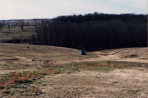 undamaged trees. Many large Eastern red cedar were uprooted and, where accessible, are being salvaged. We expect to have at least 60 acres rehabilitated by the end of March 2010. Some intermittent losing stream channels were partially blockade by fallen and uprooted trees and this would potentially result in stream bank
 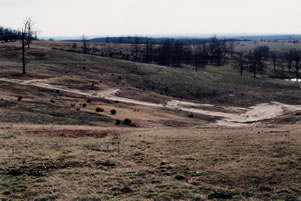 cutting with increased sediment yield to the cave stream. Debris was partially cleared from some of the most important losing stream segments. Partial funding for the restoration work has been provided through the U.S. Department of Agriculture.
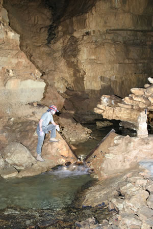
Cave restoration work is being conducted by the Springfield Plateau Grotto of the National Speleological Society. This work has included the removal of graffiti and mud deposited on speleothems in the East Passage prior to the purchase of the cave and construction of an initial gate by the Aleys in 1966. The cave has been protected from unauthorized entry since 1966. The protection was greatly enhanced in 2000 by the purchase of the Bear Cave entrance and in 2004 by the construction of the chute gate on the Bear Cave entrance.
Lands owned by the Foundation and the Aleys was accepted into the Conservation Stewardship Program of the Natural Resource Conservation Service, U.S. Department of Agriculture in January 2010. This will provide significant funding for five years to expand conservation programs on our lands. We are delighted.| © Copyright 2009 Tumbling Creek Cave Foundation | Top | Website by John Babcock Illustration and Design |